 ">
">

Frozen Over on the Appalachian Trail
This morning it was freezing cold waking up. My toaks cup full of water was frozen solid and so were my other water bottles. Last night I slept fine and fell asleep almost immediately. But I was slow to get up this morning. My first alarm went off at 4:30am as always, but I slept a bit longer. We were up pretty late last night.
Some time before 6am I began making a hot drink to get the day started. I kept all of my layers on except for my alpha pants, which seemed like they would be overkill as we began our day by climbing. Then eventually got packed up and we started walking around 7am. The air was frigid and the snow that covered the trail was frosted over by last nights low temperatures. It must have been in the single digits. Once again my contact solution partially froze, which is nuts because that’s saline solution!
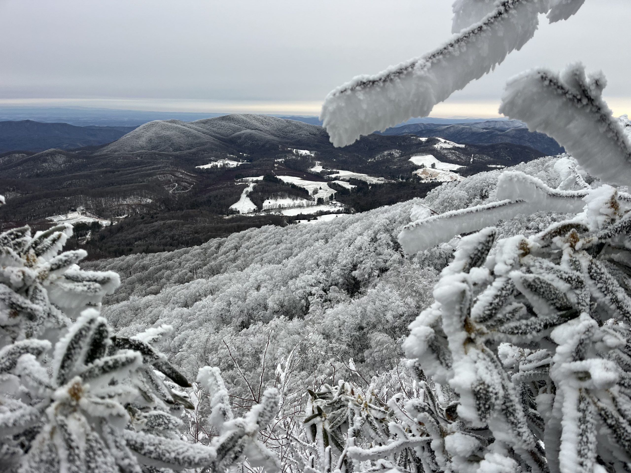
Snowy branches covering up a Mountain View.
The morning started with a relatively easy climb up to Little Rock Knob. It was so cold out that even in my layers I didn’t heat up too badly. Then we descended down to a road, before starting the climb up to Roan Mountain. Which I knew was going to be a pretty long and steep climb. Over the next few miles the trail was pretty rough. As we climbed up toward Roan Mountain the snow got alot deeper. And there were a ton of blowdowns. It reminded me a lot of the section of trail prior to Spivey Gap. Whole sections of forest had been completely knocked down. And while a lot of sections had been cleaned up and moved off the trail, there were still alot of obstacles left in our path. We found ourselves climbing up and around downed trees a good bit.
The views this morning were incredible!
The icing on the cake though was the ice. The higher we climbed up Roan Mountain, the more frequent the large patches of iced over trail were. There were some sections where the entire trail had turned into a thick ice rink. We had to climb up on the side of the trail and make our way through the trees and brush to get around. Otherwise I definitely would have slipped on the ice. It was so thick and unbelievably slippery. Some sections were easy enough to go around. You could just skirt the side of the trail and try to only step on rocks or powdery snow. But that wasn’t always the case.
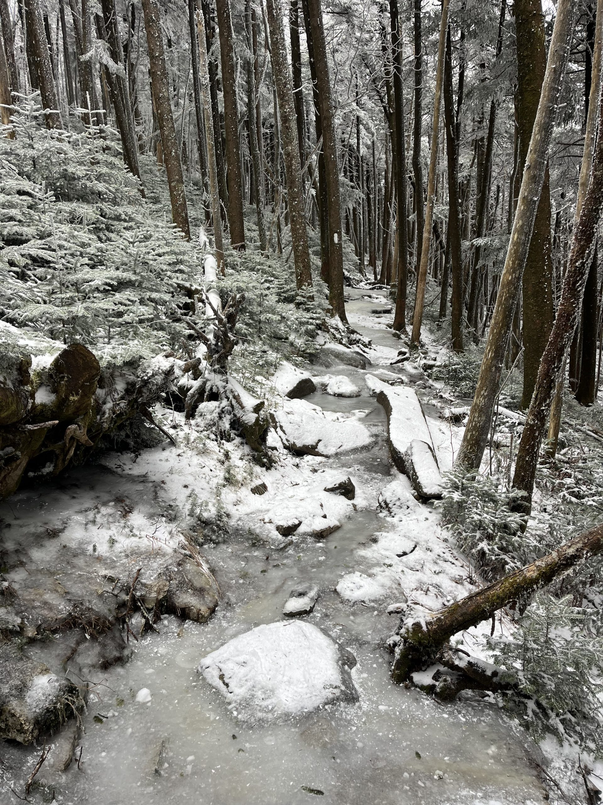
The trail was like an ice rink when you were climbing up toward Roan Mountain.
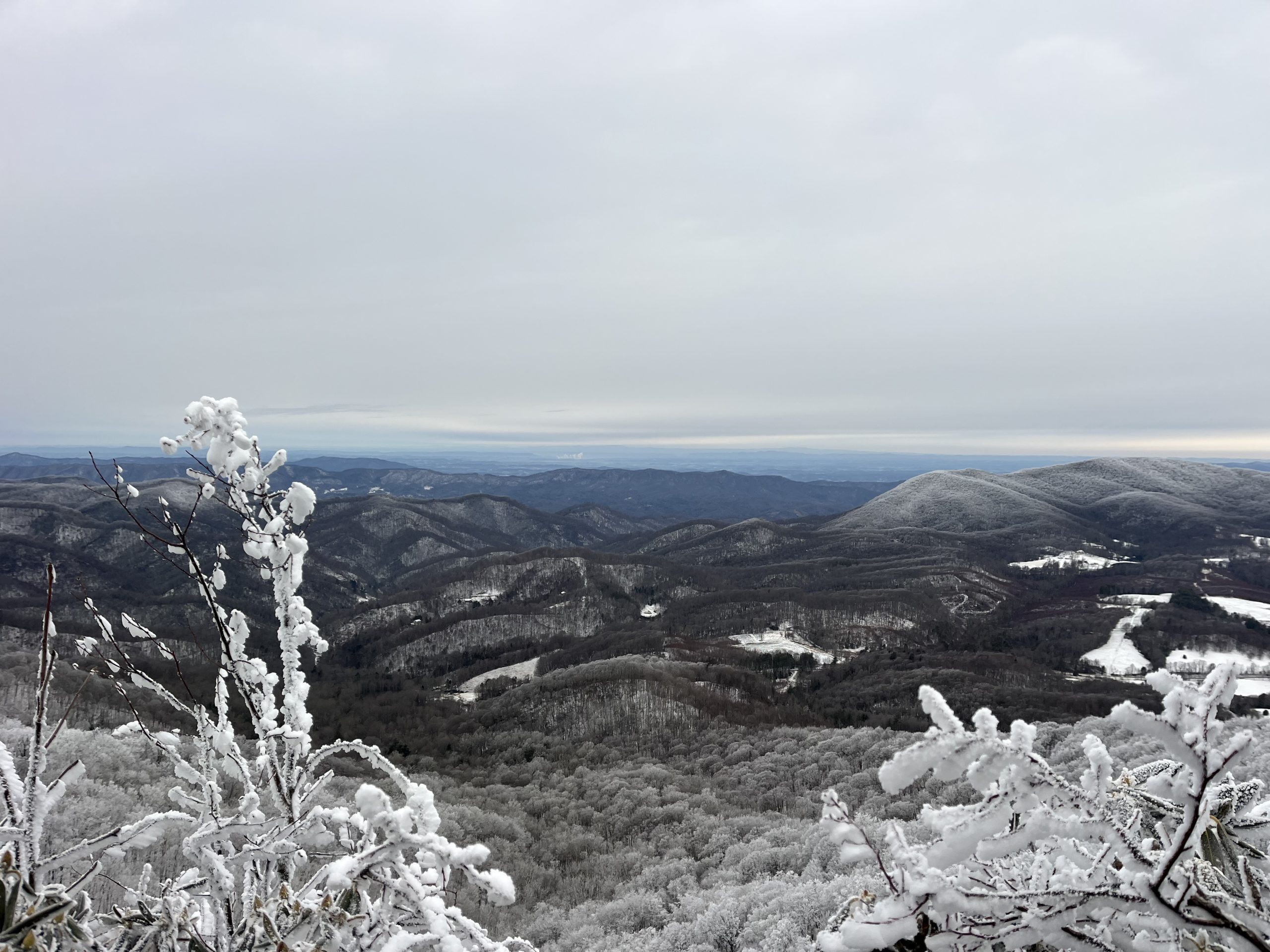
I thought that we were up on top of Roan Mountain pretty quickly, but had forgotten that the climb had a bit of a false summit. You hit a high point and then begin descending, before beginning the final climb up to the top. The iced over trail and downed trees continued all the way up. There were sections where the trail was merely covered in snow and was much easier to cross. But even the thick powder snow slowed us down. I was surprised by our pace in the early part of the day. Managing 3 MPH is usually sustainable for us, but not when you add in all of the time we were spending to get around our new obstacles. But nonetheless we pressed on, simply going as fast as we could under the current conditions.
Heading down one of the grassy hills in the snow.
Within the first few hours of the day my feet were already pretty wet. But it was alot warmer than yesterday and this morning. So I was still comfortable. Up near the top of Roan Mountain I got service and got a text from my friend Ricochet. We hiked about 800 miles of the PCT together in 2022. He’s also attempting the calendar year triple crown this year and began his hike on the AT. He started a while before us, while we were still down in either northern Florida or Alabama.
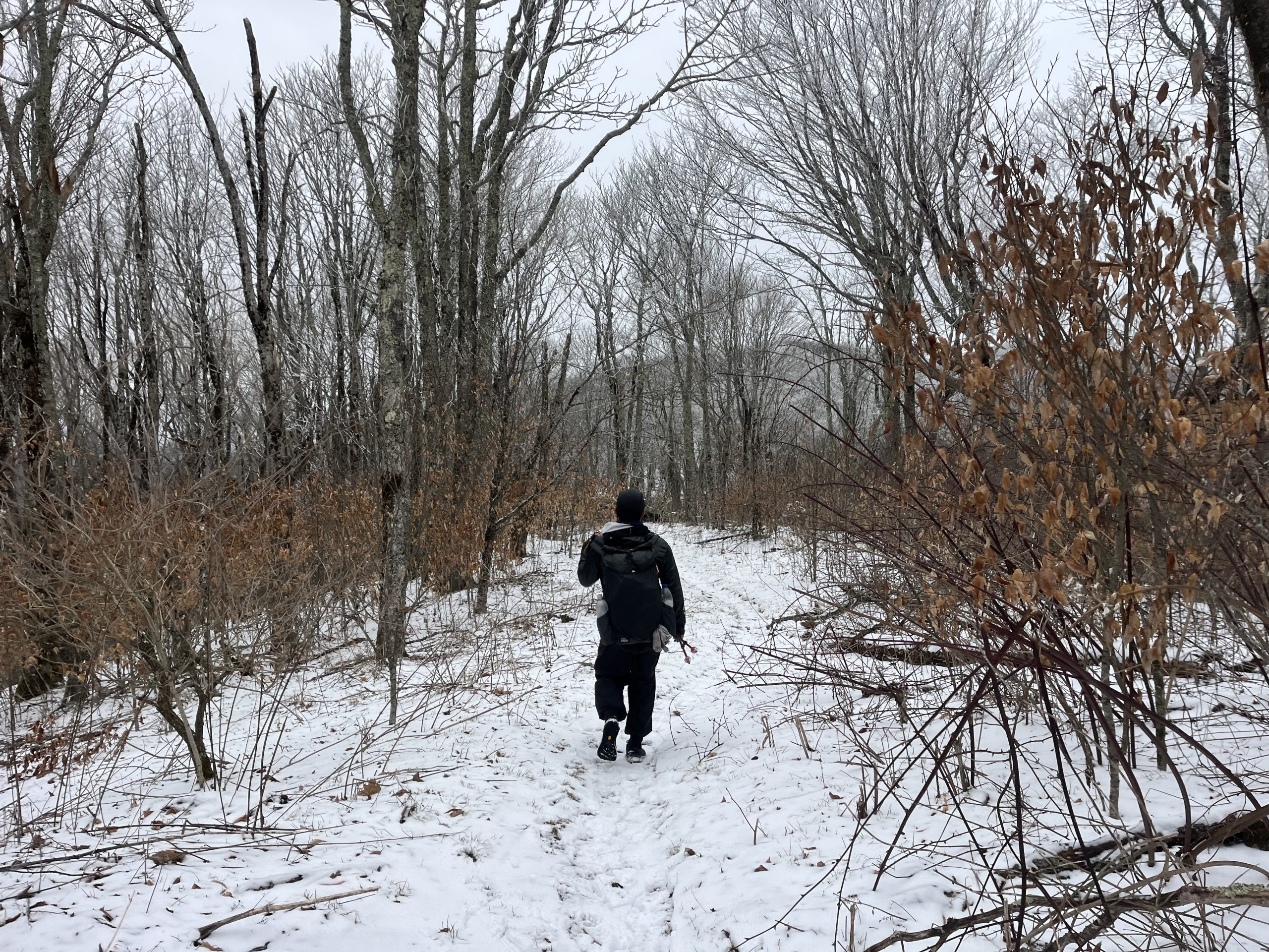
Punisher up ahead along the snow covered trail.
But because the trail had so much ice and snow back then, he wound up getting a wound on his foot. The snow numbed his feet too so he didn’t even realize when it was happening. After a day of walking he had a large open cut on the inside portion of his foot. And in the week that followed it wound up getting incredibly infected. He started to notice symptoms and eventually got off trail to go to the hospital. It turns out he had gotten a staph infection, which is really scary!
The infection was so bad that he had to get off trail for 3 weeks, and is getting back on today! He also just so happens to be getting back on trail 8 miles north of where we camped last night. Which is incredible. So I’m hoping at some point today we will come across him! We’re planning to do 33 or so miles today. And I think Ricochet is planning to ease back in and nurse his foot to the best of his ability. So it’s only a matter of time until we run into each other.
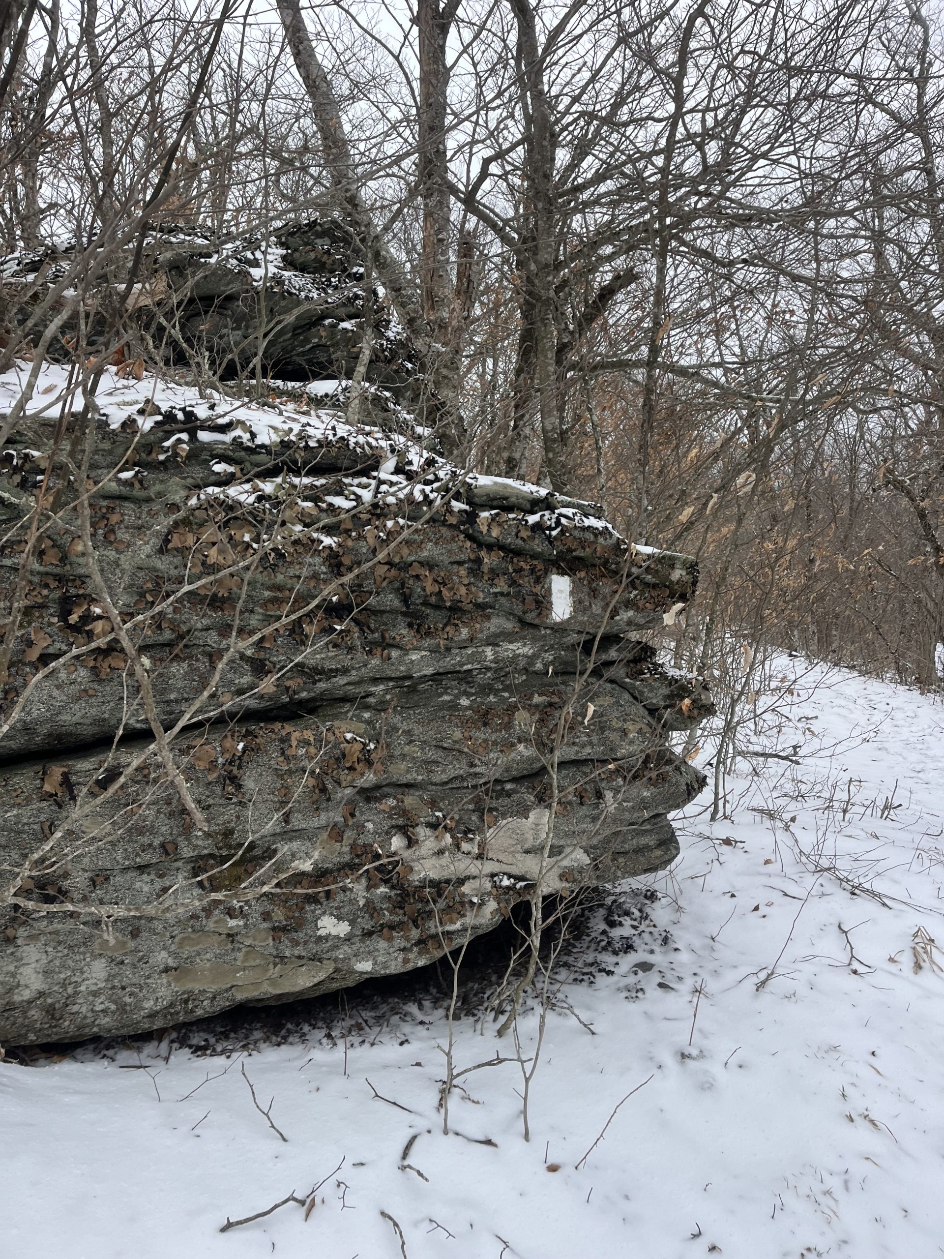
A rock with the white blaze on it.
Coming down Roan Mountain there were a few more patches of ice. But eventually it was just all snow to deal with as we continued down. In some areas it was only an inch or so of snow. But depending on where we were there was as much as 3-4 inches. On our way down the mountain we ran into some day hikers. Those were the only hikers we had seen since leaving Erwin.
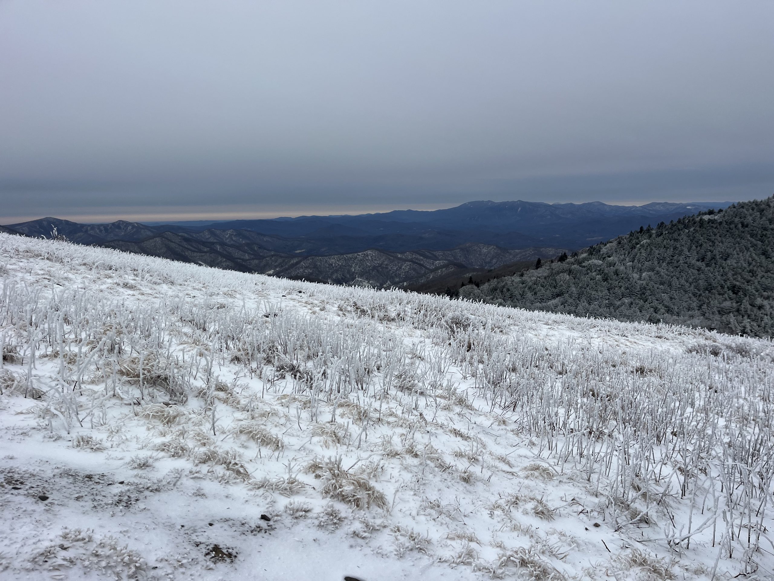
The trail dropped us down to Carver’s Gap, a trailhead parking lot alongside a road. We walked down to take a look and see if anyone was there. Then continued along the trail as it began climbing up to Round Bald. On our climb up we saw a whole bunch of day hikers! The snow may be bit slow going, but it makes for beautiful views. I can understand why so many people are out today. The views going up Round Bald were so vibrant. The sky was bright with pinks on top of the bright blue mountains. Standing on top of the snow covered bald and looking off at that view in the distance was one of the highlights of my day.
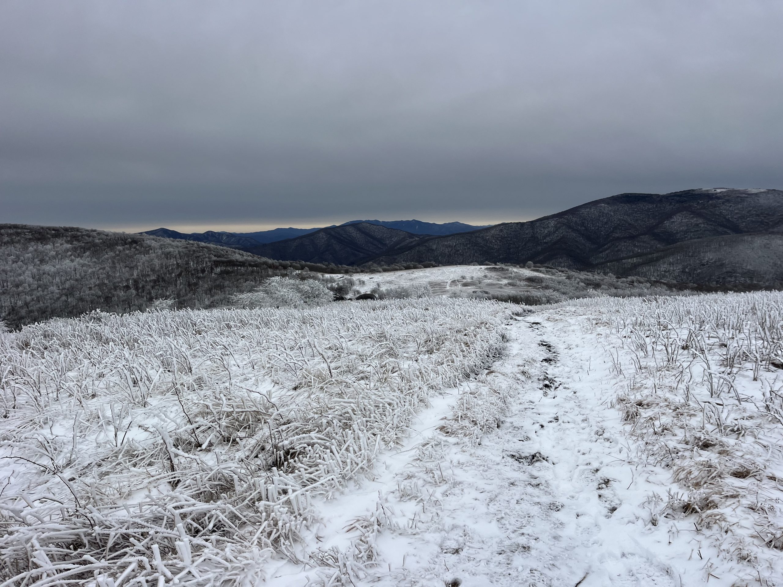
It might have been cold and snowy today but the views were unbeatable.
The climb up was fairly easy. Then right as you think you are about to continue climbing up, the trail quickly veers off. For once the AT takes the low route! I remember being shocked in 2023 when I was here. When you look off at the trail ahead of you it really appears that the climb continued. Instead you begin a pretty long descent. Then began climbing up to another view point, Jane Bald. This was another gorgeous climb. The views were wide open and the visibility couldn’t have been better. It was even starting to warm up! We climbed up to another view point and then began a long descent.
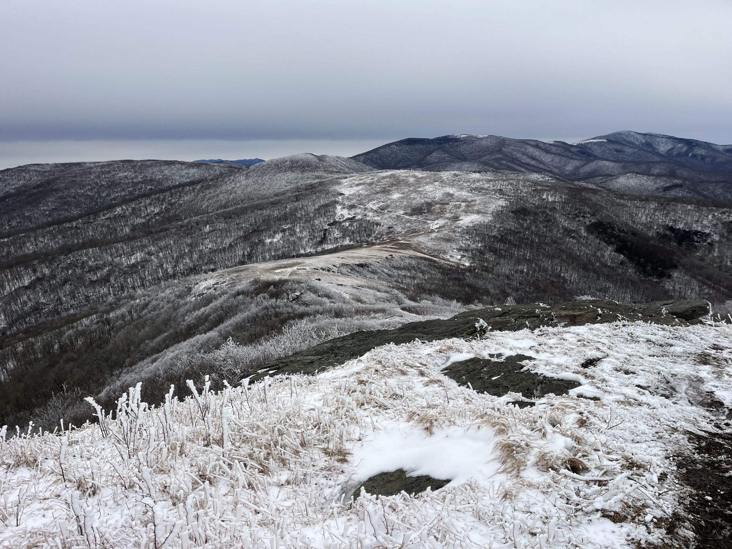
Climbing up one of the last balds before we began descending toward the highway.
On our way down we went past Stan Murray Shelter and there was a hiker there! We hadn’t seen a thru hiker for the last 2 days, over the course of 40+ miles. His name was Candy Man and we chatted for a bit. Then we continued up a small hill before we began doing downhill again. Around this area the trail goes by a spur trail, where the Overmountain shelter used to be. That was the iconic red barn, right in the middle of a big field. The views from the barn were incredible and I spent a great night there on my last AT thru hiker. Since then the ATC has had that shelter torn down. Even though upon acquiring the property the ATC was supposed to maintain the shelter for hikers. It’s sad that it was torn down and likely won’t be rebuilt. That was one of my favorite shelters on my entire AT thru hike previously. This time around we just walked on by.
After passing by there the trail begins climbing up Little Hump Mountain. Which was a pretty steep climb! Right before starting I took my alpha 120 top off. Which was a great call. Because I warmed up ridiculously quickly on the way up. Which only went on for about 30 or so minutes. There was still a lot of snow on the trail as we got up to the top as well.
The snow up top was actually much deeper than any of the snow we’d seen all day. It was pretty cold and windy up top as well. But almost as quickly as we got up we began descending once more. It felt good to get bundled back up briefly and get to lower ground. Then I was perfectly comfortable once more. As we made our way down we could see some hikers off in the distance heading up the next mountain. I was excited to continue on and see who they were.
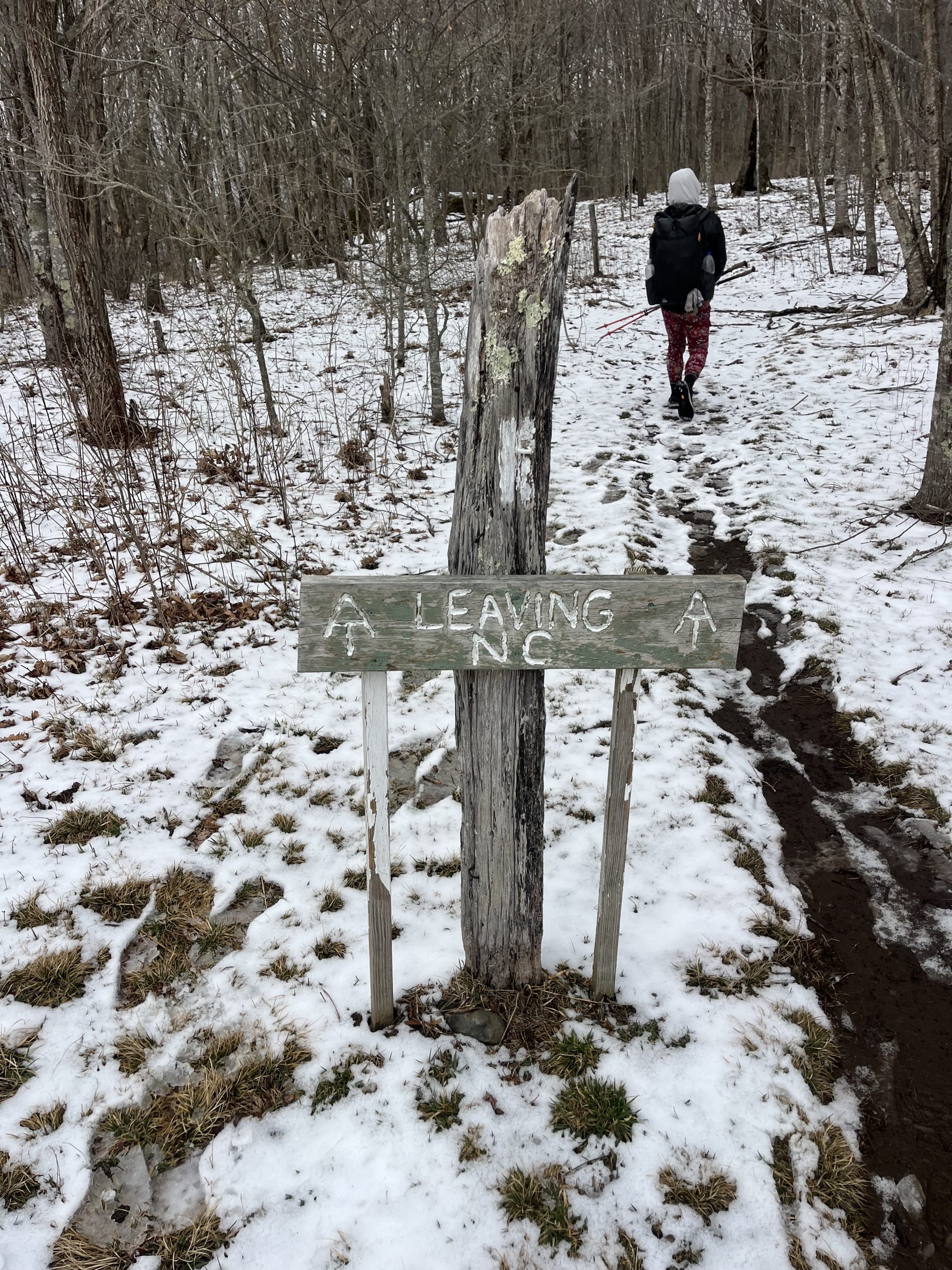
Finally crossing out of North Carolina and into Tennessee! Another state down.
Once we dropped down to Bradley Gap we began climbing up Hump Mountain. Which felt just as steep as the previous climb, if not steeper. But the hardest part wasn’t the climb itself. It was actually the trail! The snow was deep on and off, there was crunchy ice covering loose dirt, and all of it just made for a slow climb. My feet would slip and skid, or the trail would get so narrow that you had to walk along the side of it instead. That continued all the way up to the top and made me go a lot slower. I just couldn’t keep a good footing what so ever.
Once we got up top though it was all downhill from there. The top itself had the deepest snow that we had hiked through all day. If you didn’t try to walk in other people’s footprints then your foot would just sink completely in piles of snow. Once again the worst part of that was really just that it slowed me down. When you have such a big day of mileage ahead of you, anything that slows you down is going to feel a little annoying.
The descent down to US-19E was about 5 miles long. The snow was still pretty prevalent until we got closer to the road. There was ice here and there but more than anything there was a lot of slush now. The sun was out and was starting to melt the snow. Every now and then I would slip and slide a bit. At one point I was messing around with something in my fanny pack, and my foot slipped all the way up from under me. But because of the angle of the trail I actually only made contact with my pack on the ground. So I just bounced right back up without feeling a thing. That was probably the luckiest fall I’ve ever taken.
After descending for a few miles the snow even began to disappear! I’m hoping that the rest of the day we won’t be hiking through anymore snow. There isn’t a lot of elevation gain coming out of US-19E either, so I’m hopeful.
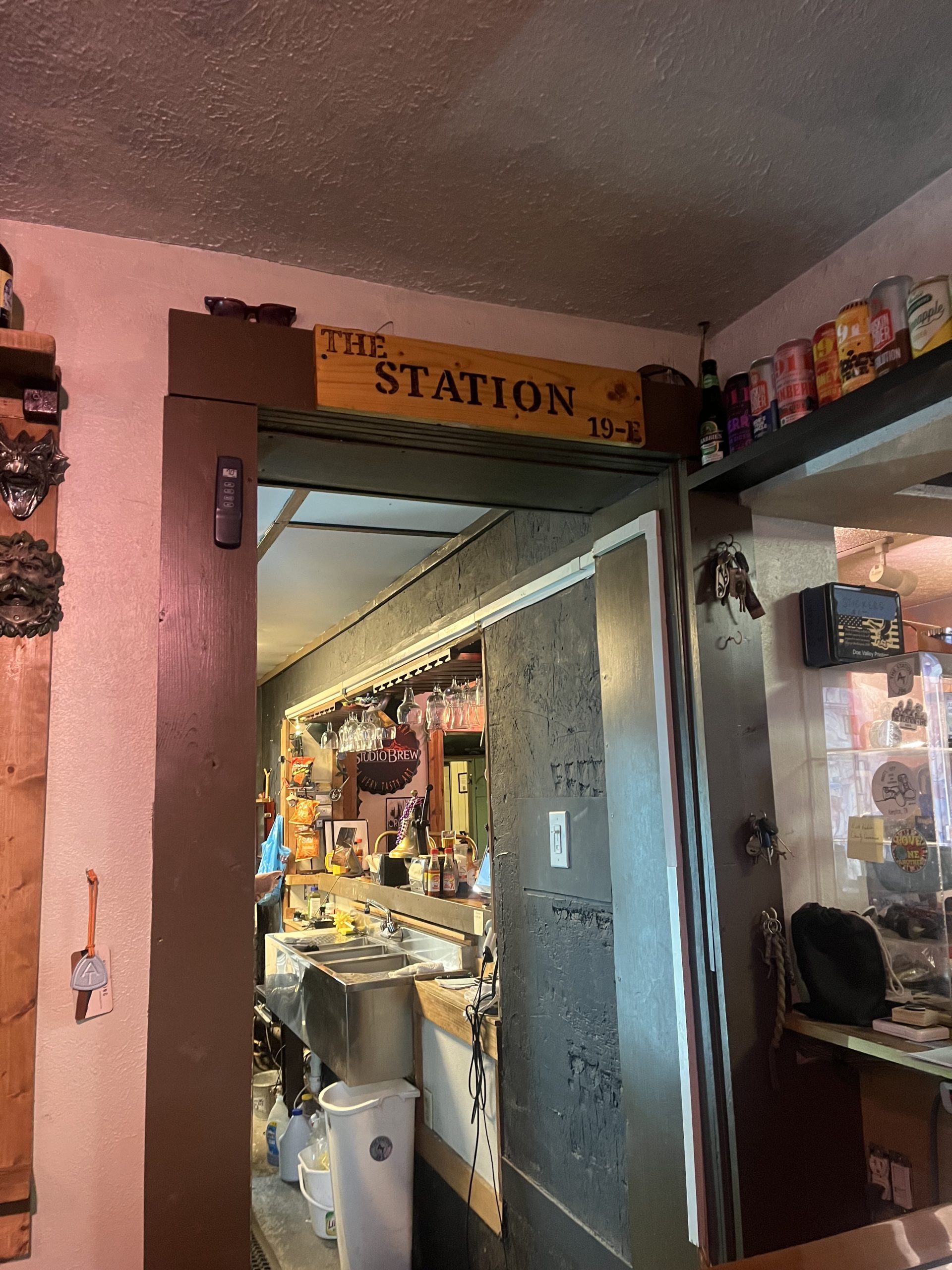
Having a quick early dinner at Station 19E.
It was around 4pm when we finally got down to the road. And at this point we had gone about 25 miles already for the day! Right now we’re planning on going over to Station 19E quickly for a bite to eat. That’s a hostel which also has a restaurant and bar inside. Their food is amazing and that place has an awesome vibe. When I was here in 2023 I stayed at Mountain Harbor because I wanted to try their legendary breakfast. But we went over to Station 19E for food and had an amazing time there.
Station 19E is .7 miles down the road. But after walking and hitching for a few minutes we got a hitch! The guy was so nice and gestured for us to put our packs in the boat he was towing. Then it was just a quick trip down the road to the hostel. I was so pleased to see that they were open! We’re so early in the season you just really never know. But apparently Station 19E never closes for the season actually.
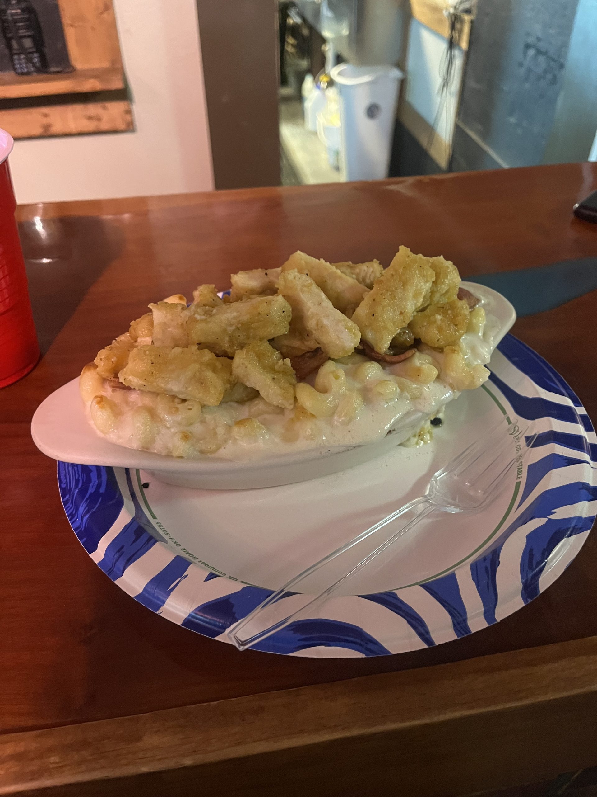
The hiker Mac n cheese at Station 19E.
When we got inside we were greeted by all of the nice guys that work there. Crazy Wolf was working who I met in 2023. He’s a really cool dude and it was great to get to talk with him again. Along with the other two guys which were working either behind the bar or in the kitchen. There’s a fridge at the front of the bar that has loads of different sodas and drinks in it. You just take whatever you’d like and have them put it on a tab for you.
I wound up having a Dr Pepper and then ordering garlic Parmesan chicken Mac n cheese. Last time I was here I actually had the buffalo Mac n cheese. I remembered that it was really good and was a massive portion. While we sat there I had to use the WiFi to get some video editing and blog writing done. I didn’t have service last night so I wasn’t able to finish everything. Then today we were just so busy hiking on difficult terrain that I couldn’t multitask.
We stayed at Station 19E for about an hour. From there we would only have about 8-9 miles to go to get to the Mountaineer Falls Shelter.
The rest of the day was actually really nice. The trail was incredibly well manicured near the road. I appreciated that for as long as it would last. There was one decent climb coming out from the highway. But then the rest of the day was just small rolling hills and nothing too significant. It made for a nice easy way to end off the day. By the time that we got to the shelter for the night, it was definitely going to be late. But not as late as last night.
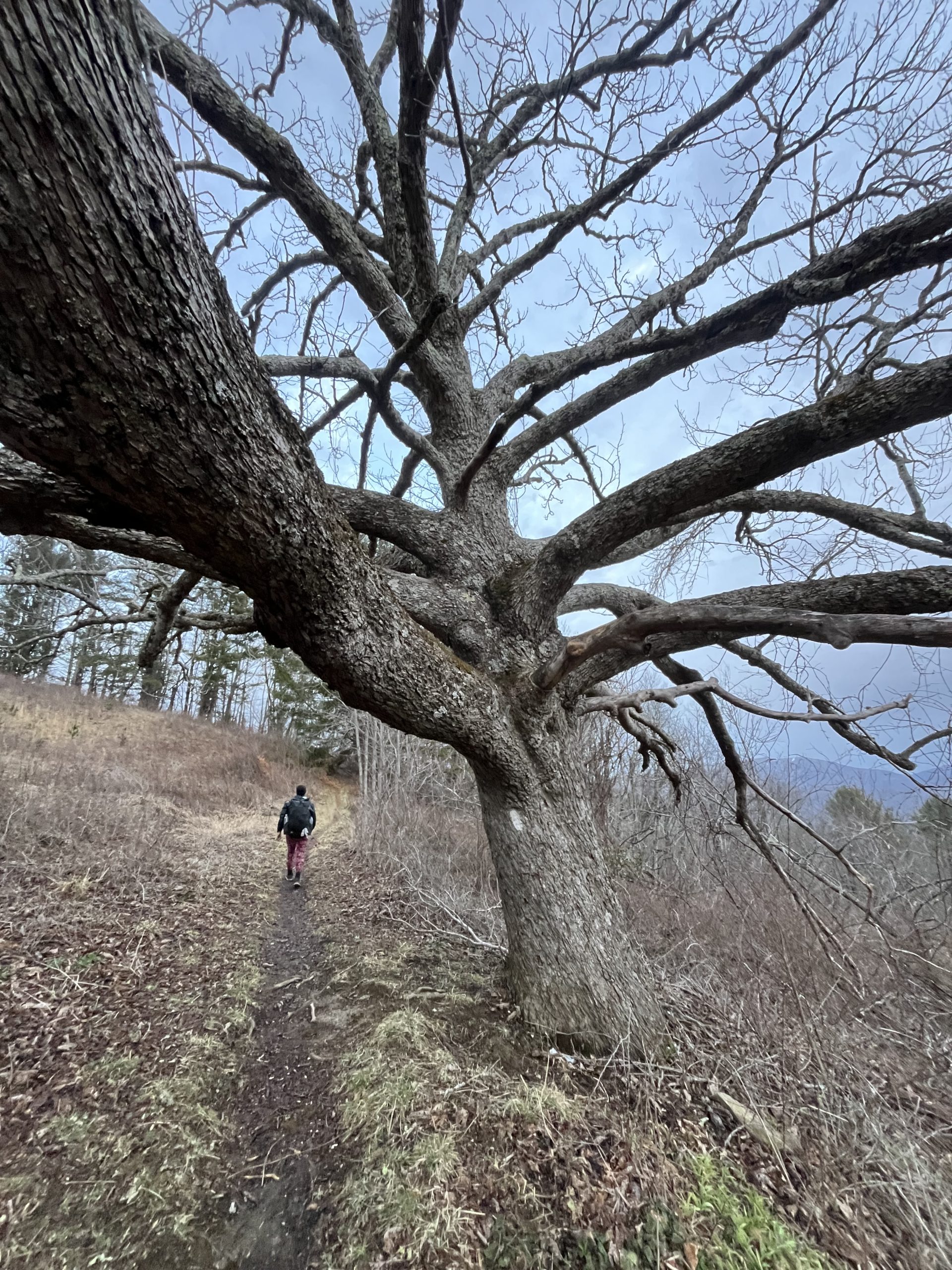
I absolutely loved this massive tree that the trail went past.
The trail brought us past a couple of waterfalls and was nice and easy. Though after a little while we did hit a large stretch of blowdowns. It was trimmed out pretty well, but every now and then you had to navigate around something. As we made our way down to the river though the destruction was wild. I believe there used to be a lot more forest down there, which has basically been wiped out.
Then once you got back into the woods there were a whole lot of trees down.
Most of the downed trees were easy enough to get around. We still made good time on our way to Mountaineer Shelter. And just after 8pm we arrived! I was shocked to see that the shelter was empty though. Ricochet had been ahead of us today, so I was expecting him to be at the shelter. We hadn’t passed him along the way here.
I just figured that we must have missed him along the way. Once we arrived at the shelter we got situated for the night. I ate a cold dinner again tonight just to save time. I had some cheese, chips, chocolate, and couple other snacks. Then I managed to get some writing done before calling it a night.
If you enjoyed this blog and would like to support my hike by buying me a soda or a snack along the way, there is a “Tip the Author” button below! It links directly to my Venmo. Any and all support is incredibly appreciated!

This website contains affiliate links, which means The Trek may receive a percentage of any product or service you purchase using the links in the articles or advertisements. The buyer pays the same price as they would otherwise, and your purchase helps to support The Trek's ongoing goal to serve you quality backpacking advice and information. Thanks for your support!
To learn more, please visit the About This Site page.
Comments 5
Wow just wow PL! I just can’t believe that you managed all those miles in such difficult conditions!! I guess I shouldn’t be surprised after following your journeys, but Roan mountain is tough in the best conditions without having the addition of ice and snow!!! Hope you catch up to your friend – please look after yourself and your feet ❤️💜❤️
I’ve told you I did the AT in 81. I can’t imagine doing any part of Tn. or NC. in the snow or ice. I’ve spent a total of 3 weeks in my life backpacking in snow, but I expected it. I Love your positive attitude! My wife & I would be cursing Mother Nature with cold feet and blow downs.
What a surprise it’s cold and frozen when walking in the winter. Wait until you walk at night 😆
Your photographs of the snow, ice, dark blue/gray mountains and the views are wonderful. Thank you.
This part of the AT is where hubby & I frequently hike year round as it’s very close to us (we live on 321 at watuaga lake). I love your descriptions and pics and wish you safe hiking this year!